Operational Procedures Set-up:
CATUAV has been operating UAS for commercial applications since the launch of Atmos 1, our first fully functional system (Check here our discontinued range of Aerial Services we used to provide). We have experience in flying in multiple environments (urban, night flight, extreme temperatures…) in all sorts of operation modes (VLOS, EVLOS, BVLOS, FPV…). Furthermore, we have taken care of keeping up to date our operational procedures to the ever-changing legal framework.
Our experience allows us to support you in properly deploying any new application, assessing you in:
- Technology selection: Selecting the right UAS technology is key to properly succeed in your project. We can help you in analyzing the technical requirements of the project and find the best solution available in the market to meet those.
- Safe operation: Once the suitable UAS has been selected, it is important to properly define the operational procedures to ensure the maximum level of safety through all operation steps. This includes taking into account the orography, expected meteorological conditions, take-off and land area configuration, sources of interference…
- Regulatory compliance: Complying with all UAS regulations may be difficult and sometimes ambiguous. We can help you in guaranteeing the legality of the operational procedures and obtaining all the permissions from the relevant NAA (National Aviation Authority).
- Economically feasible: Fulfilling all previous points means nothing if the application is not economically feasible. From our experience we can estimate the multiple costs associated with the UAS operative to optimally set-up your application work-flow and proceedings.
If you want to know more about how our capabilities can benefit your project check our know-how list or read about some of our most relevant projects below:
FLUXPYR – 2009 to 2012
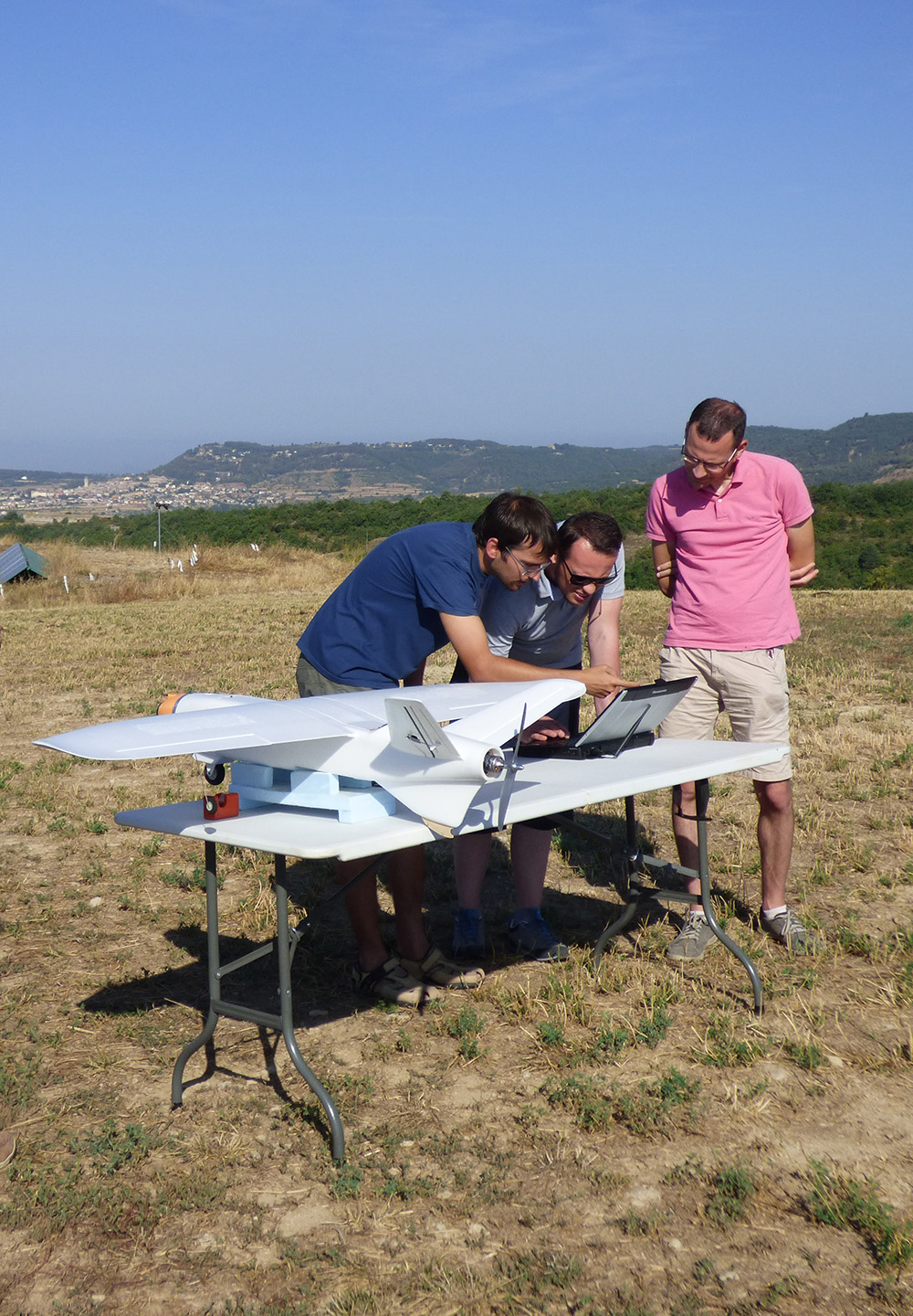
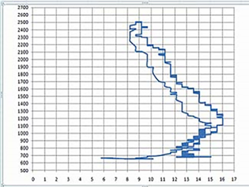
CATUAV and the Catalan Institute for Climate Science (IC3) closed an agreement to conduct a flight campaign to measure the levels of CO2 in the atmosphere. These flights were part of the FLUXPYR project and are intended to complement and contrast the observations of the IC3 network of atmospheric stations. CATUAV performed a special integration for the CO2 probe in the Atmos-5 UAV platform, specific calibration flights and sounding campaigns ...
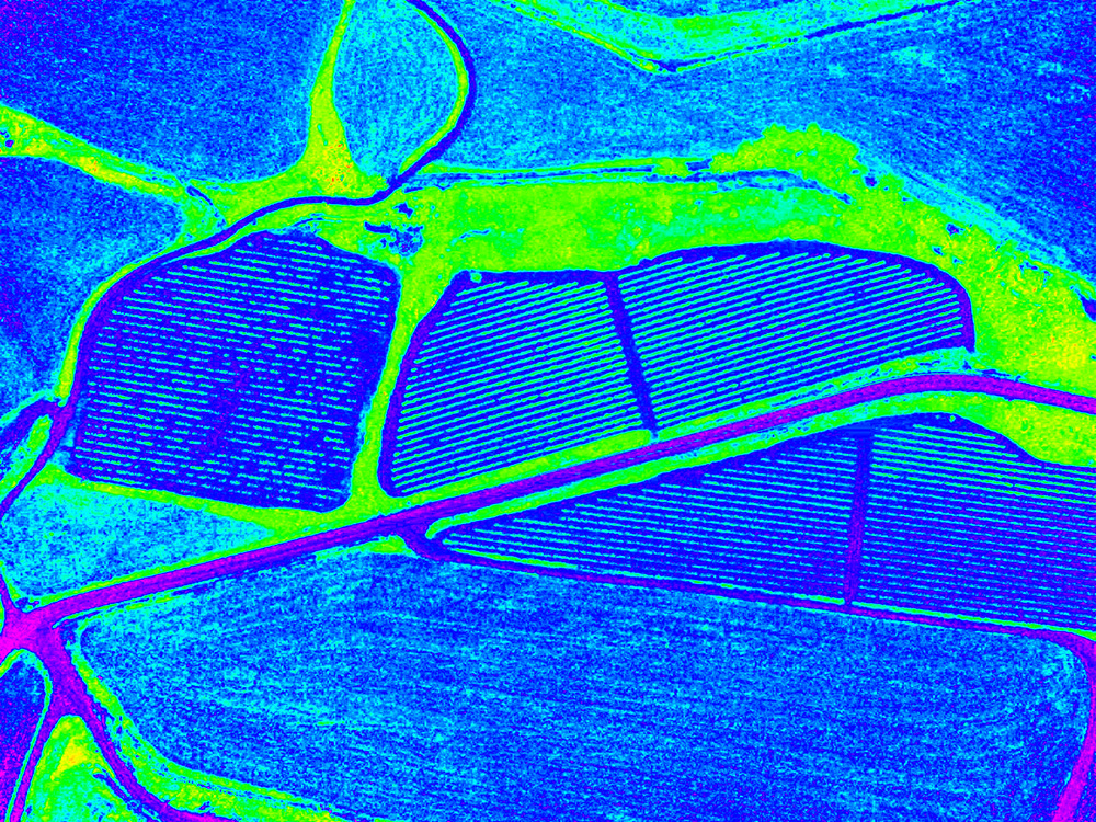
PRECISION AGRICULTURE: ABADAL – 2008
Precision Agriculture is a farming management concept based on collecting relevant data of crops variability in order to optimize farming processes and save resources. Remote sensing techniques used in precision agriculture usually benefit from acquiring airborne data with multispectral and thermal cameras which is correlated with on-site field measurements to extrapolate relevant information from the crops, such as vegetation vigour or water stress. Traditional imagery was acquired with satellite and manned airplanes, but it had ...
ITUMA – 2008 to 2010
ITUMA (Investigación de Tecnologías para un sistema integral UAV para control del Medio Ambiente) was a project subsidized by ACCIÓ that allowed CATUAV to strengthen its technological base. This project lasted for 3 years and brought together 4 companies (Aurensis, CATUAV, Geovirtual and Pildo Labs) and 2 subcontracted public agencies (CTAE and Institut de Geomàtica). The aim was to develop and test all necessary technologies to bring Earth observation environmental drone applications into a market stage. For CATUAV ...
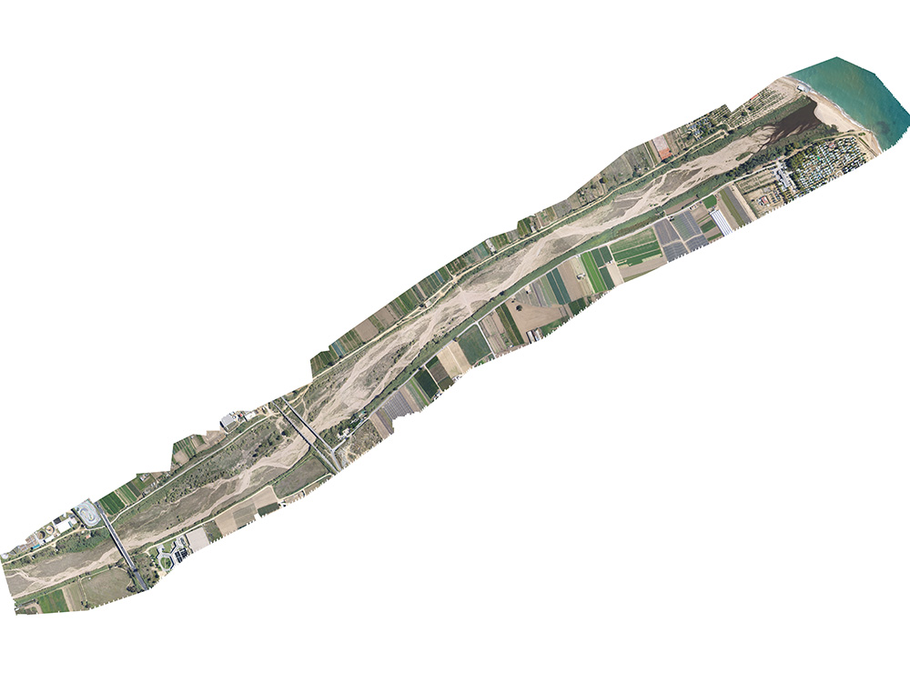
AERIAL MAPPING: TORDERA – 2008
Two major technology advances allowed the use of drone data to generate orthophotomaps: The first one, was the continuously improvement in handheld digital cameras for the customer market. With a continuous increase in resolution while lowering the price and weight of these cameras, they were suitable to be used on board drones for acquired high resolution imagery. The second one, was the computational power increase in personal computers that brought the appearance of the first ...
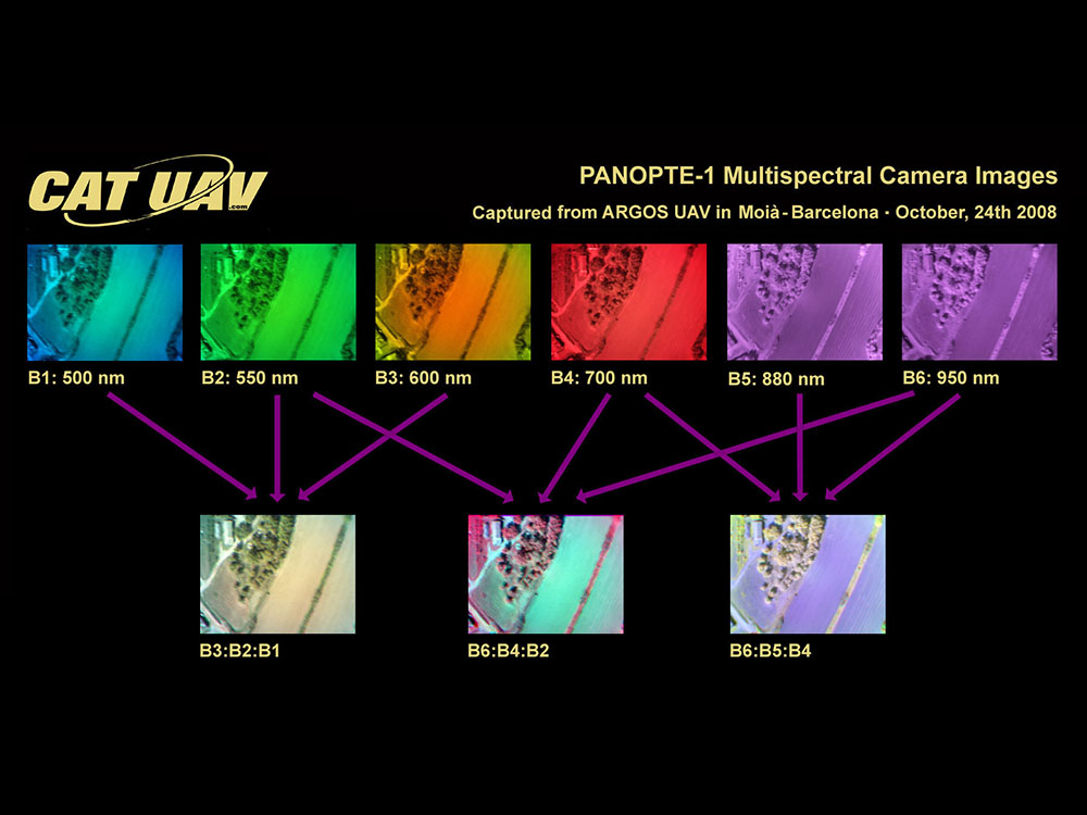
PANOPTE MULTISPECTRAL CAMERA – 2008
Before the appearance on the market of Micasense, Mapir, Parrot and DJI multispectral cameras, the only commercial option for multispectral cameras was offered by Tetracam, which, apart from being very expensive, due to their size and weight was not intended to be integrated into a small UAVs such as Atmos. Thanks to the experience of Dr. Manuel Castillo Fraile in remote sensing projects, CATUAV managed to develop a three-band camera based on the FOVEON sensor ...