Operational Procedures Set-up:
CATUAV has been operating UAS for commercial applications since the launch of Atmos 1, our first fully functional system (Check here our discontinued range of Aerial Services we used to provide). We have experience in flying in multiple environments (urban, night flight, extreme temperatures…) in all sorts of operation modes (VLOS, EVLOS, BVLOS, FPV…). Furthermore, we have taken care of keeping up to date our operational procedures to the ever-changing legal framework.
Our experience allows us to support you in properly deploying any new application, assessing you in:
- Technology selection: Selecting the right UAS technology is key to properly succeed in your project. We can help you in analyzing the technical requirements of the project and find the best solution available in the market to meet those.
- Safe operation: Once the suitable UAS has been selected, it is important to properly define the operational procedures to ensure the maximum level of safety through all operation steps. This includes taking into account the orography, expected meteorological conditions, take-off and land area configuration, sources of interference…
- Regulatory compliance: Complying with all UAS regulations may be difficult and sometimes ambiguous. We can help you in guaranteeing the legality of the operational procedures and obtaining all the permissions from the relevant NAA (National Aviation Authority).
- Economically feasible: Fulfilling all previous points means nothing if the application is not economically feasible. From our experience we can estimate the multiple costs associated with the UAS operative to optimally set-up your application work-flow and proceedings.
If you want to know more about how our capabilities can benefit your project check our know-how list or read about some of our most relevant projects below:
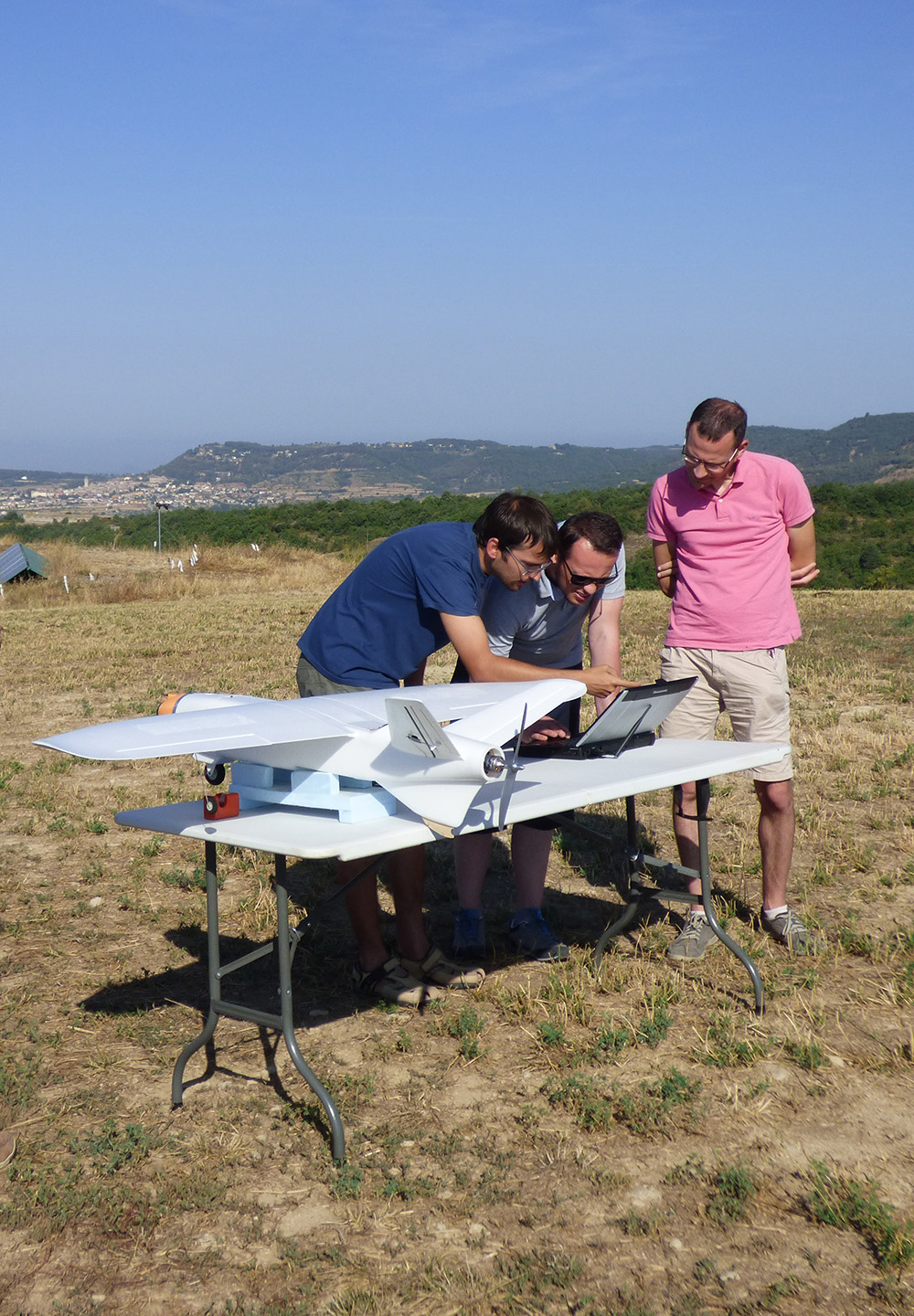
ALDRONE – 2015
Today there are 110M landmines deployed in 78 countries, including in Europe, killing up to 20,000 a year. The removal of landmines is slow and manual, dangerous (for every 5000 mines cleared 1 worker is killed and 2 injured), and costly ($300–1000 to remove 1 mine). In the past 5 years less than 1000 km2 worldwide were cleared of mine. At this pace it will take 1100yrs to remove all the landmines. To meet these ...
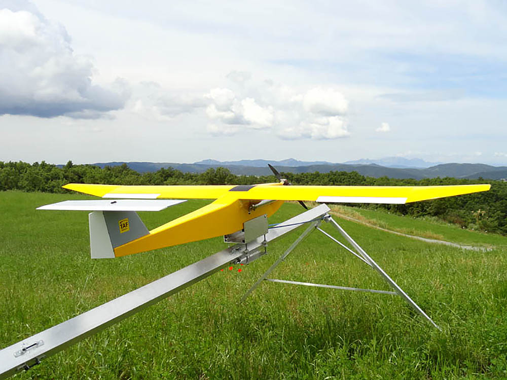
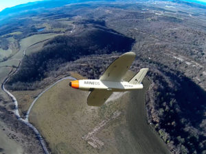
Firefighting Drone – 2014
TAF Helicopters commissioned CATUAV to develop a new and improved version of the ARGOS platform to complement the services it has provided with helicopters since 1963. The main objective was to monitor forest fires with a thermal camera at night, flying during the time when manned airplanes are not allowed to operate. During the project CATUAV developed a new launching ramp that allowed the system to be operated anywhere, a parachute recovery system for emergency ...
PHYTOSCOPE – 2012 to 2014
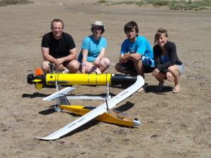
Phytoscope (stands for PHYToplankton biOdiversity multiScale Characterization using advanced Optical technologies) was carried out in the Alfacs bay as a scientific campaign to collect data for the Phytoscope project. This campaign was organized by the ICM (CSIC) and directed by Dr. Jaume Piera. CATUAV participated capturing thermal images with the NEC F30 camera and hyperspectral images with the new RIKOLA. In total, CATUAV made 14 UAV flights that will show the variability of the control ...
MESTRAL – 2012 to 2015
The main goal of the project MESTRAL (stands for Modelling and advanced observational tEchnologies to link tranSport processes, opTically-active constituents, and wateR light-field vAriability in a coastaL ecosystem) was to investigate the presence of small-scale transport processes in the Alfacs Bay, and how they affect the spatial patterns of optically active constituents (sediments, phytoplankton and dissolved organic matter) and the underwater light-field variability. Over three years the Marine Technology Unit (CMIMA / CSIC), directed by Jaume Piera, ...
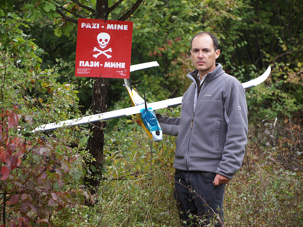
SAFEDEM – 2011 to 2014
SAFEDEM (Space Asses For Enhanced De Mining) was a project funded by the European Space Agency (ESA) to validate the use of both satellite and drone imagery to help in the demining activities. CATUAV participated in the project with the acquisition of multispectral data in the visible, near-infrared and thermal bands. Two flight campaigns were carried out in Bosnia in partnership with the BIHMAC (Bosnia & Herzegovina Mine Action Center) in order to test the ...