Since year 2000, we have been working in multiple kinds applications such as: precision agriculture, emergencies, humanitarian applications, civil constructions, marine projects, atmospheric studies, environmental projects, archaeology, power lines, energetic efficiency…
Although nowadays our business model is not based on providing aerial services, all these different applications have granted us the necessary experience to setup and deploy optimized and safe operational procedures, allowing us to provide UAS operation services for R&D and new cutting edge applications.
AERIAL MAPS
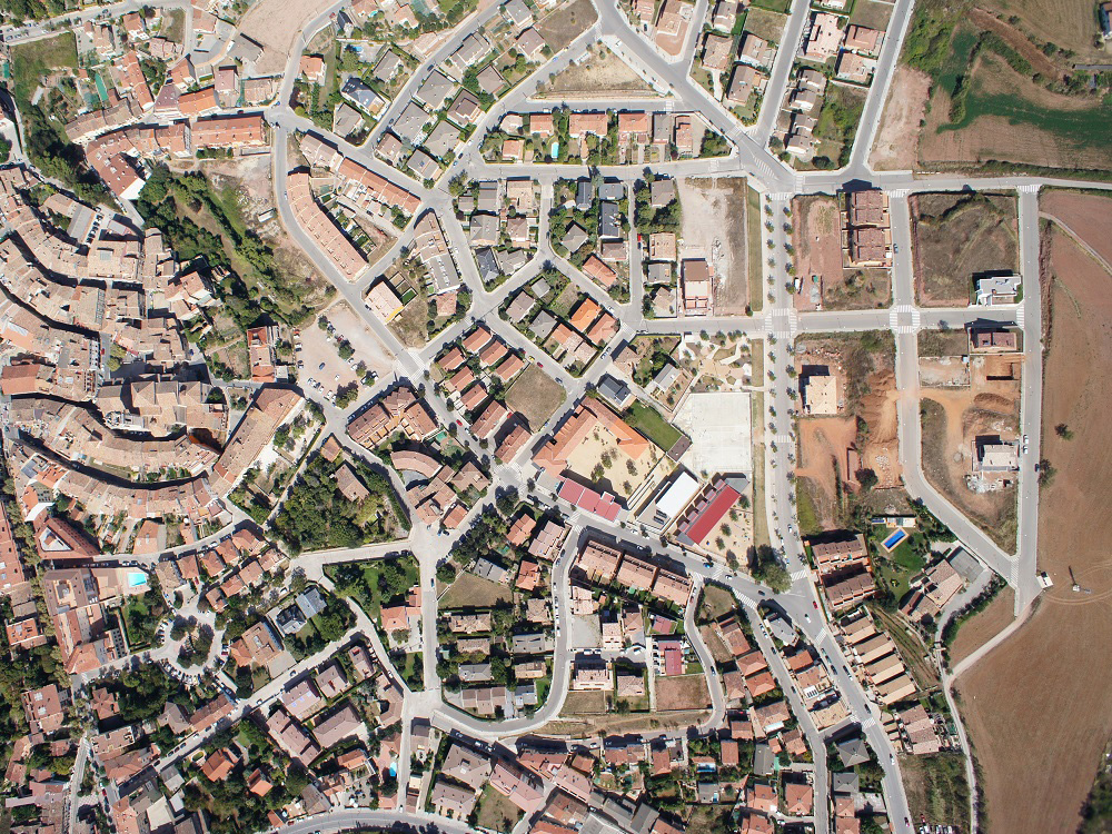
Stitching together multiple images a high resolution map can be generated which can be used to measure distances and surfaces.
3D MODEL RECONSTRUCTION
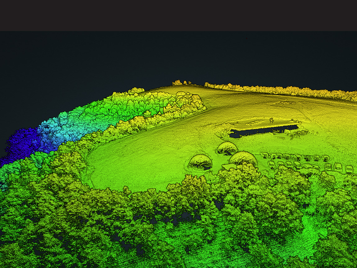
When generating a map a full 3D reconstruction of the surface is generated, allowing the measurement of altitudes and volumes.
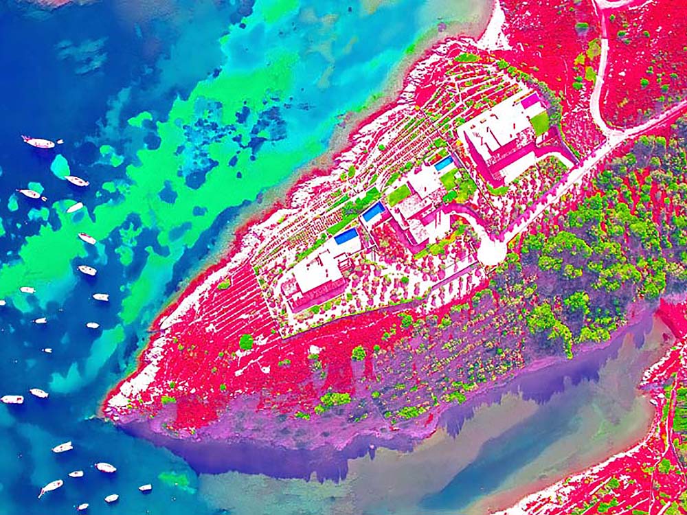
MULTI & HYPER-SPECTRAL IMAGERY
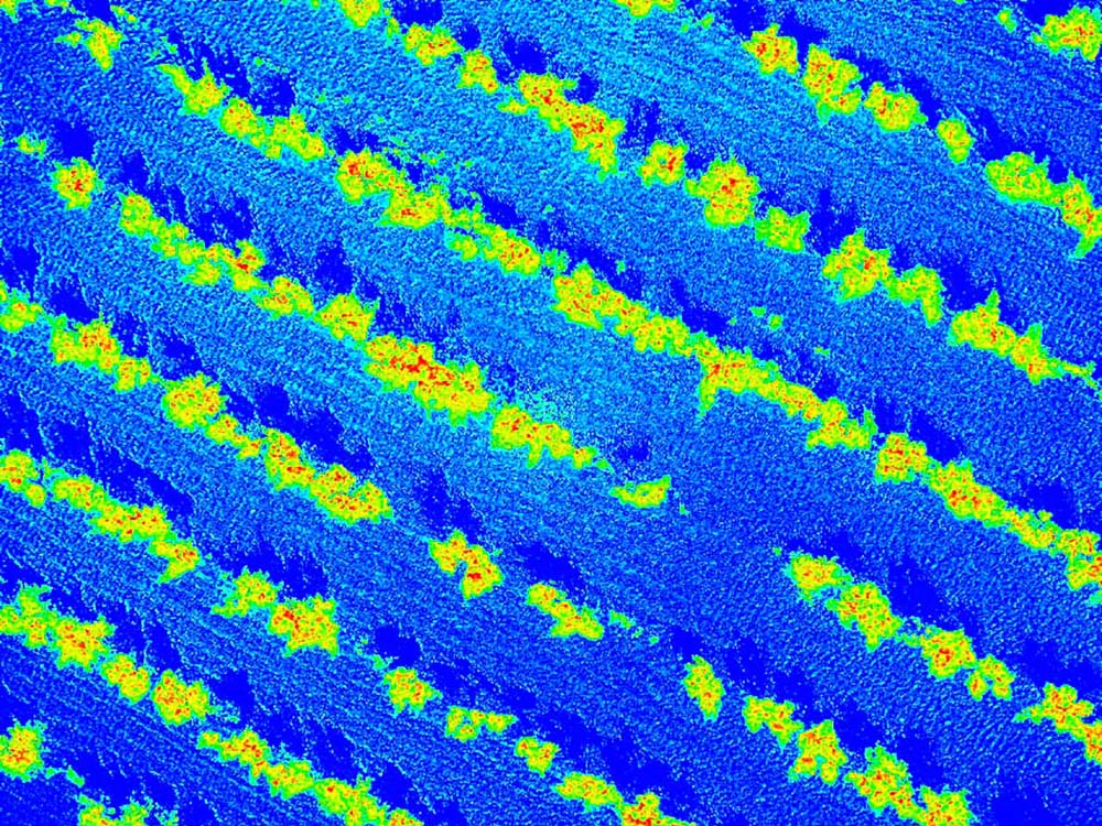
The combination of multiple spectral bands allows us to get information about the sensed objects, such as the vegetation growth.
THERMAL IMAGERY
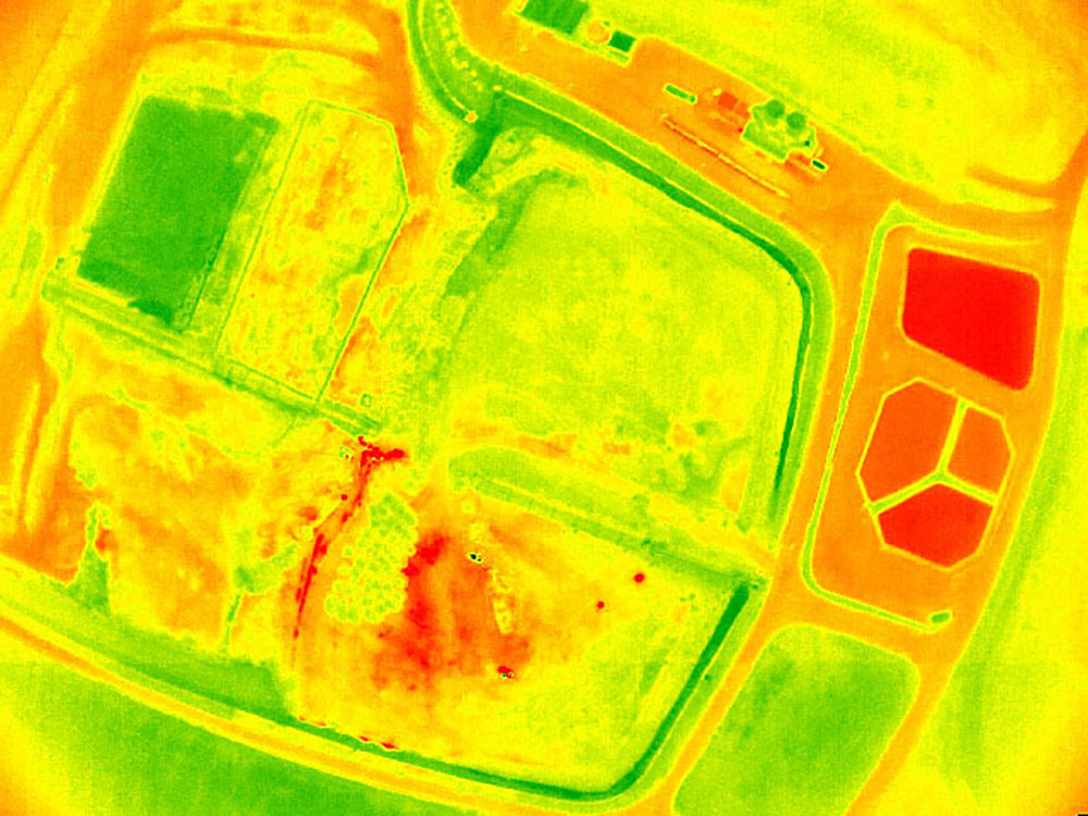
Using radiometric calibrated thermal imageries the temperature of the sensed objects can be estimated.
REMOTE SENSING
Multispectral data can be combined and analyzed with remote sensing techniques in order to get relevant information for any desired application.
FEATURED APPLICATIONS
Since year 2000 CATUAV has performed a wide range of applications. Read about the most relevant missions that CATUAV has fulfilled in the past.