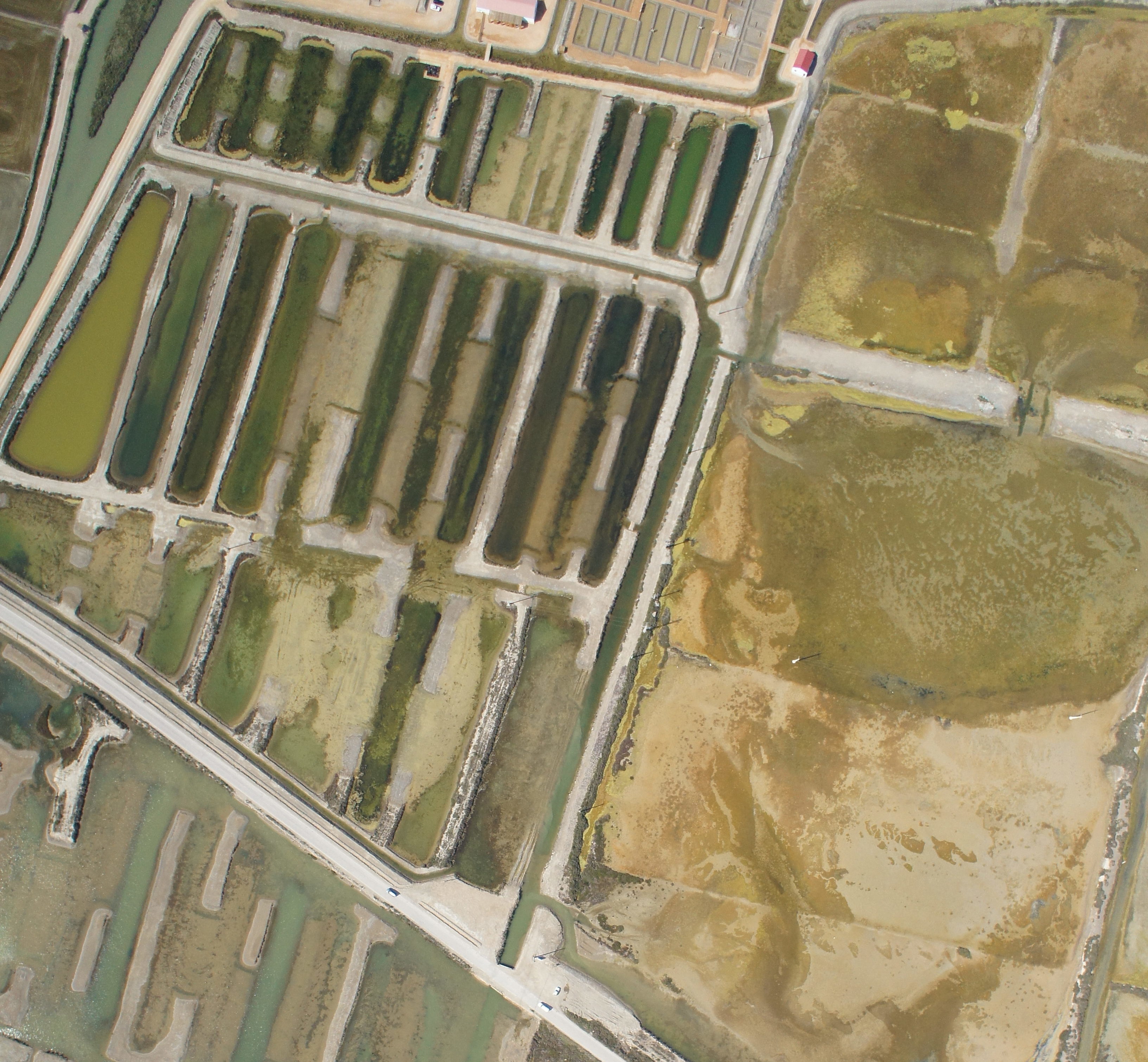
Orthophoto Maps:
The images acquired during an UAV flight can be combined into a single image to generate an orthophoto map. Orthophotos are aerial photographies that have been geometrically corrected such that the scale is uniform, having each pixel an associated geographic coordinate. Orthophotos have the same lack of distortion as maps, so they are an accurate representation of the Earth’s surface that can be used to measure distances. Combining an orthophoto map with a DSM each pixel of the final map will have the three spatial coordinates associated (latitude, longitude and altitude).
Using a combination of artificial intelligence and computer vision techniques we can rectify the aerial images acquired with our UAV systems and merge them in order to create orthorectified image mosaic of any desired extension. The quality of the final map achieved after this process is even better than the achieved using traditional photogrammetric techniques.
CATUAV covers the full technological pipeline for orthophoto map generation, from UAV operation to imagery processing, being able to deliver on-demand maps of any surface to its customers.
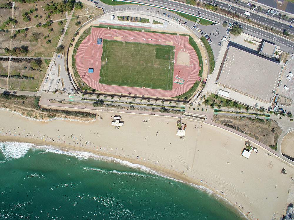
Orthophoto maps characteristics:
The main characteristics of CATUAV delivered orthophoto maps can be resumed as follows:
- Typical spatial resolution between 1 to 10 cm/pixel, depending on the camera used. If required higher resolution imagery can be produced for high precision applications.
- Precision of 1 to 3 times the spatial resolution used. Typical precision will be somewhere between 3 to 30 cm depending on the operation setup.
- Maps of any desired spectral band: RGB, multispectral or thermal.
- Georeferenced in any desired coordinate system, being compatible with any other earth observation data sources: topographic data, satellite, manned airplane orthophotos.
- Standard file format compatible with any desired GIS.
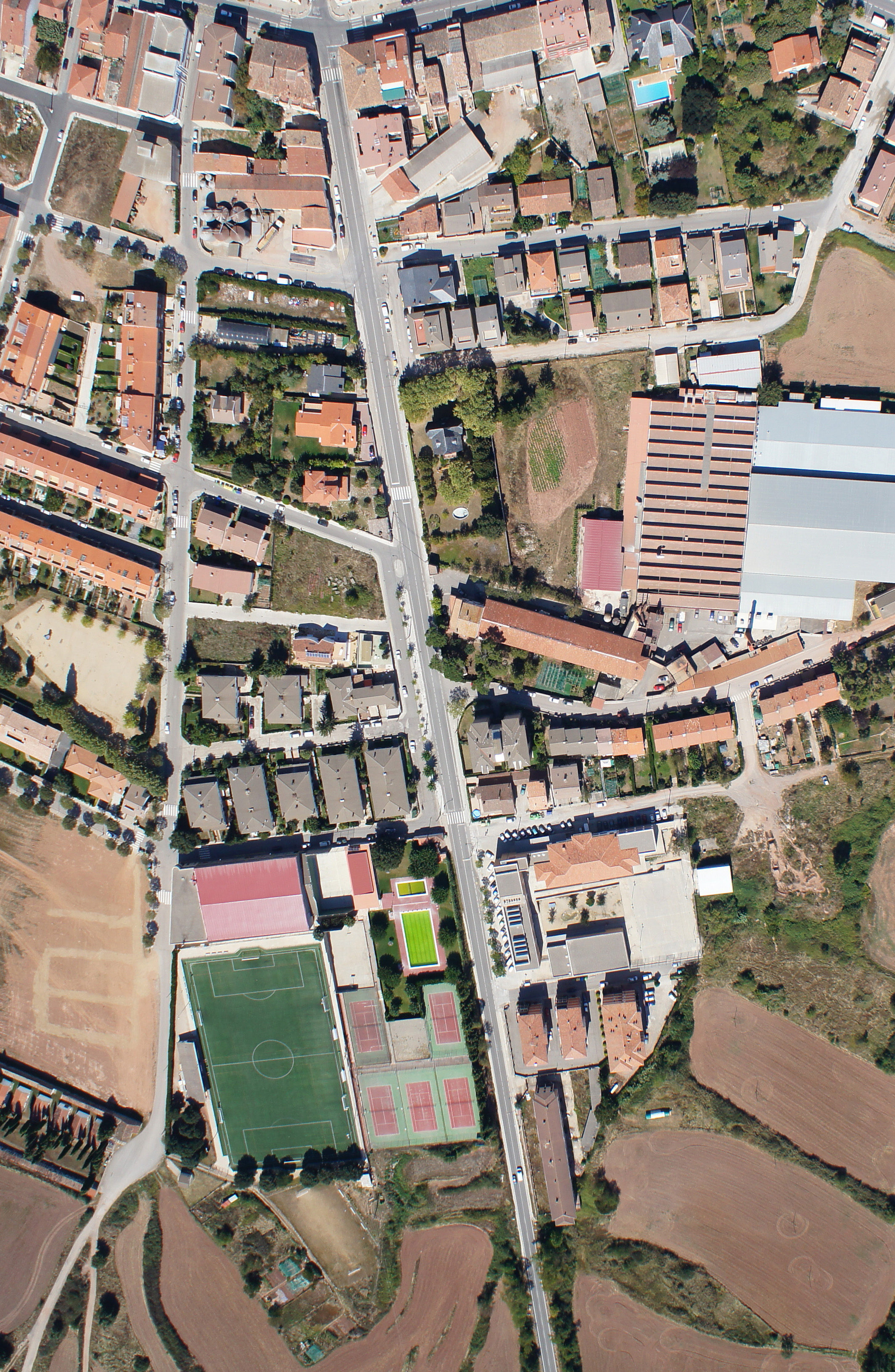
How are orthophoto maps processed?
In a short UAV flight to cover around 100 hectares more than 1.000 high resolution images can be generated. In order to retrieve relevant information from all those images they must be stitched together and combined in a single map, so the end user doesn’t have to look through all the dataset.
To be able to generate a map the images must be acquired with overlap, so they share a common area with other pictures of the same flight. This will allow a computer vision based software to find common points between the images and create a relationship between them. Thanks to this process the software will be able not only to stitch all the images and generate a high resolution orthophoto map but also create a full 3D reconstruction of the surveilled area.
Do you need an orthophoto map?
CATUAV can generate on demand orthophoto maps of any area. The only things that we need to know are:
- Surface to cover: Limits of the area of interest that has to be acquired. A typical UAV flight can cover from 50 to 500 hectares (depending on the system and camera used). If the area has to be split in multiple flights that may suppose an extra cost for the service.
- Type of data: Indicate the type (or types) of camera that must be used in the project: RGB, Near-infrared, multispectral, thermal… CATUAV systems can carry more than one camera at the same time, being able to generate multiple orthophoto maps at the same time, resulting in an economic saving when different cameras are required.
- Spatial resolution required: Acquiring high resolution imagery is possible but that means capturing more images and increasing the processing time, so a higher resolution also means a higher cost. It is importantly to wisely choose the required resolution taking into account the smallest feature that must be sensed, so the cost of the project doesn’t get too high.
- Precision required: The precision achieved will be between 1 to 3 times the spatial resolution selected (e.g.: working at spatial resolution of 5 cm will get a precision between 5 to 15 cm), so if a higher precision is needed it also will mean a greater cost. Again, it’s important to optimally choose the required precision for the project in order to adjust the final cost.
- Absolute accuracy: If the UAV data must be compared with other geodata sources, it may be necessary to have a good absolute accuracy. That usually will mean adding ground control points so the new data properly matches the historic ones. This procedure can be done using high precision GNS stations or by taking reference points from previous imagery.
Don’t hesitate to contact us to get a custom budget for your project.