In this section you can find a list of the most relevant applications that CATUAV has carried since 2000:
MARITIME STUDIES: MESTRAL – 2012 to 2015
The main goal of the project MESTRAL (stands for Modelling and advanced observational tEchnologies to link tranSport processes, opTically-active constituents, and wateR light-field vAriability in a coastaL ecosystem) was to investigate the presence of small-scale transport processes in the Alfacs Bay, and how they affect the spatial patterns of optically active constituents (sediments, phytoplankton and dissolved organic matter) and the underwater light-field variability. Over three years the Marine Technology Unit (CMIMA / CSIC), directed by Jaume Piera, ...
HUMANITARIAN AID: SAFEDEM – 2011 to 2014
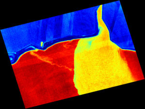
SAFEDEM (Space Asses For Enhanced De Mining) was a project funded by the European Space Agency (ESA) to validate the use of both satellite and drone imagery to help in the demining activities. CATUAV participated in the project with the acquisition of multispectral data in the visible, near-infrared and thermal bands. Two flight campaigns were carried out in Bosnia in partnership with the BIHMAC (Bosnia & Herzegovina Mine Action Center) in order to test the ...
EMERGENCY RESPONSE: LORCA EARTHQUAKE – 2011
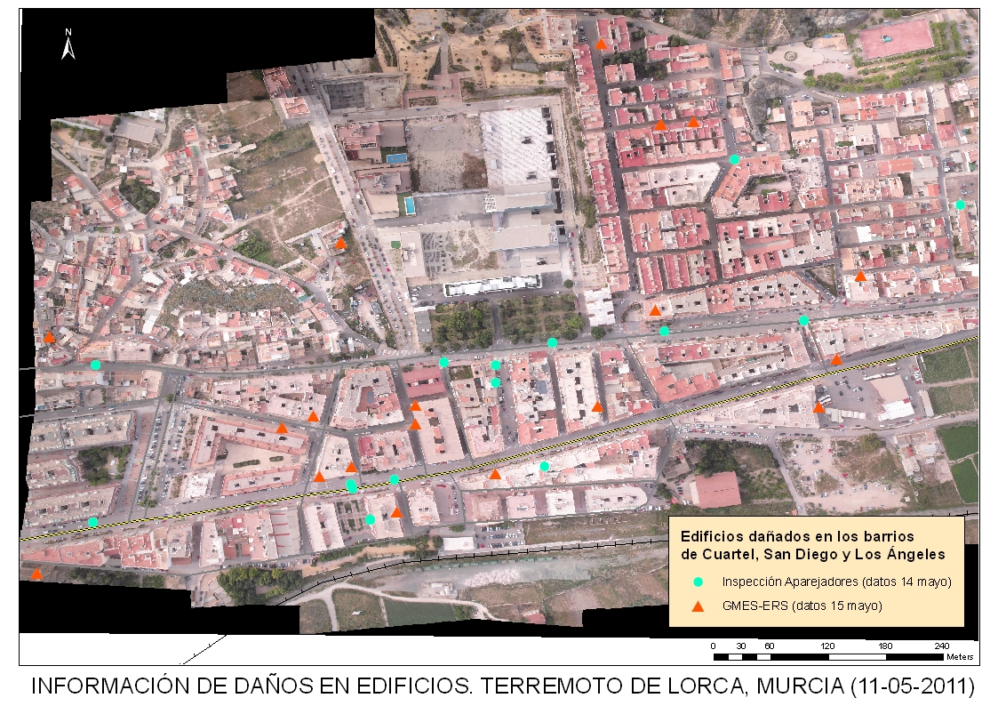
In 11th May 2011 an Earthquake of 5.1 Seismic Magnitude Scale occurred near the town of Lorca. Due to the weather condition at that moment it was impossible to get updated imagery coverage of the affected area using traditional means. CATUAV was mobilized to go to the to the area and cover the disaster. The full Lorca town was flown less than 24h after the earthquake and the an orthophotomap generated in less than 48h, ...
PRECISION AGRICULTURE: ABADAL – 2008
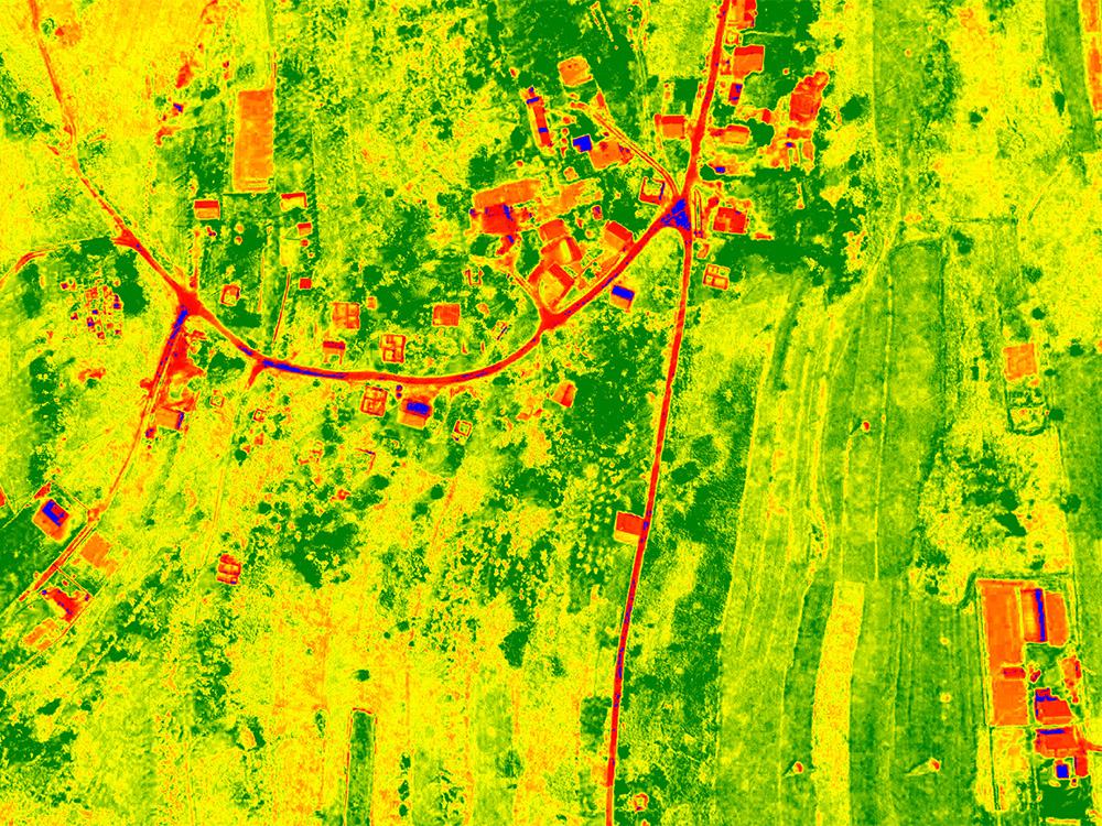
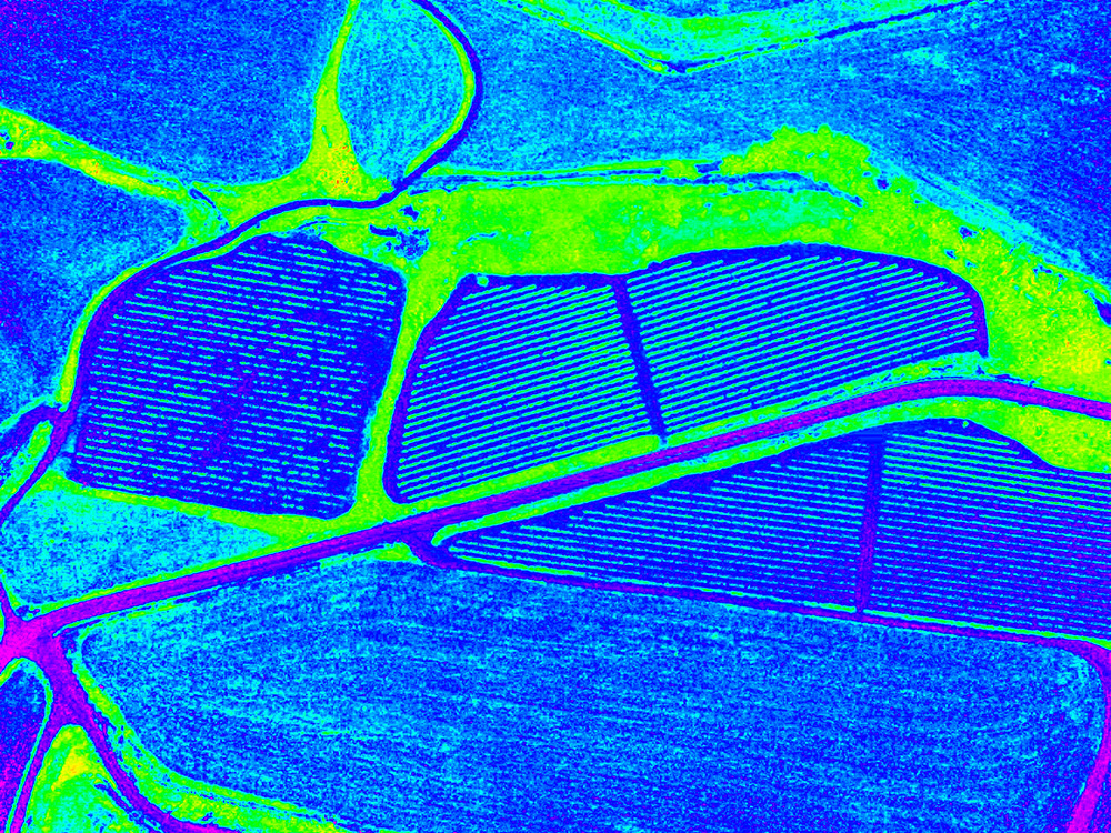
Precision Agriculture is a farming management concept based on collecting relevant data of crops variability in order to optimize farming processes and save resources. Remote sensing techniques used in precision agriculture usually benefit from acquiring airborne data with multispectral and thermal cameras which is correlated with on-site field measurements to extrapolate relevant information from the crops, such as vegetation vigour or water stress. Traditional imagery was acquired with satellite and manned airplanes, but it had ...
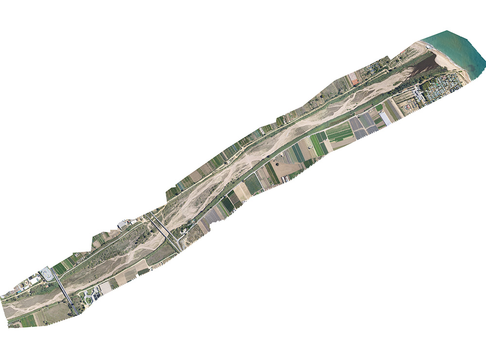
AERIAL MAPPING: TORDERA – 2008
Two major technology advances allowed the use of drone data to generate orthophotomaps: The first one, was the continuously improvement in handheld digital cameras for the customer market. With a continuous increase in resolution while lowering the price and weight of these cameras, they were suitable to be used on board drones for acquired high resolution imagery. The second one, was the computational power increase in personal computers that brought the appearance of the first ...