Orthophoto Maps:
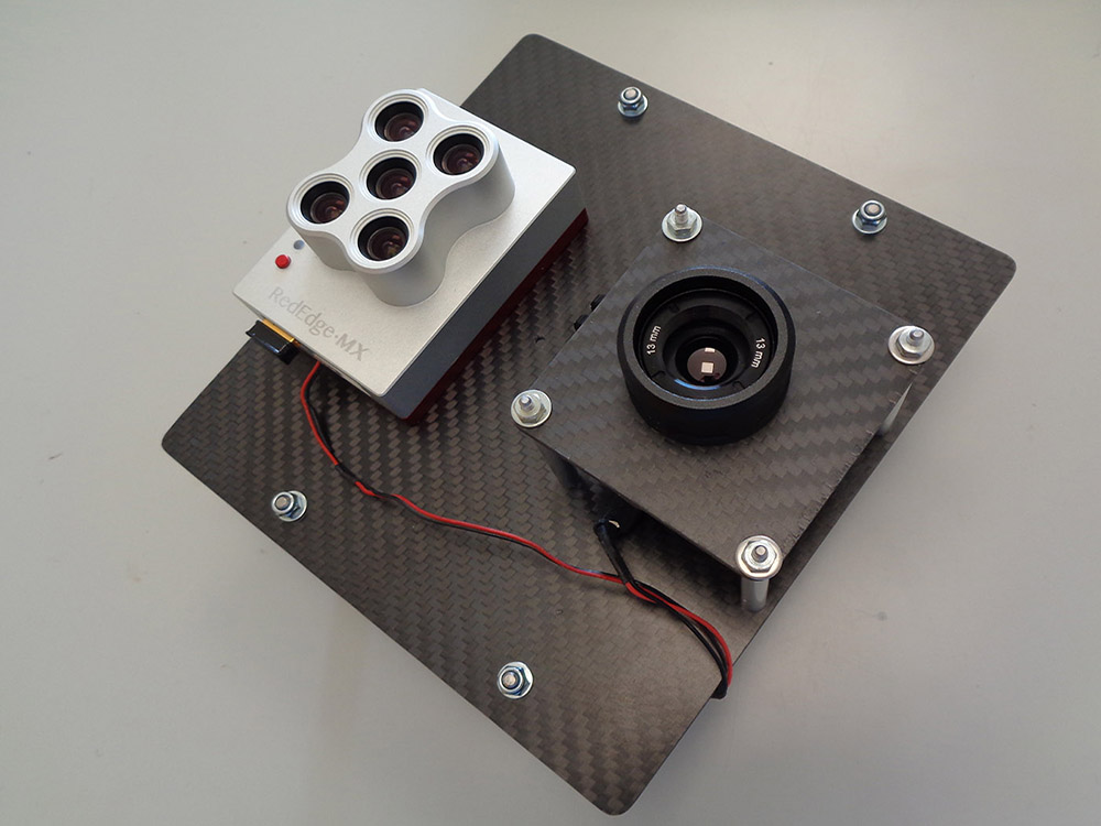
We have experience integrating and operation all sorts of sensors in our UAV platforms: high resolution RGB, multispectral, thermal, lidar… We can help you choosing the most suitable sensor for your application and integrate it in your UAS. Also we can use our UAS fleet to test any sensor performance in different conditions.
We also have experience developing and producing custom payloads, such as our Panopte multispectral camera or atmospheric sensors project.
If you want to know more about how our capabilities can benefit your project check our know-how list or read about some of our most relevant projects below:
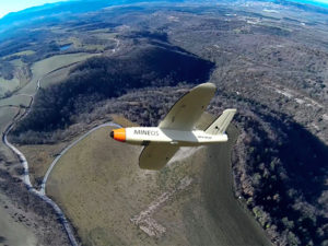
ALDRONE – 2015
Today there are 110M landmines deployed in 78 countries, including in Europe, killing up to 20,000 a year. The removal of landmines is slow and manual, dangerous (for every 5000 mines cleared 1 worker is killed and 2 injured), and costly ($300–1000 to remove 1 mine). In the past 5 years less than 1000 km2 worldwide were cleared of mine. At this pace it will take 1100yrs to remove all the landmines. To meet these ...
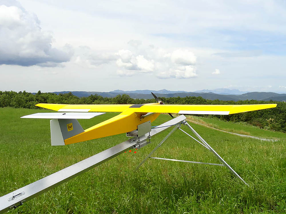
Firefighting Drone – 2014
TAF Helicopters commissioned CATUAV to develop a new and improved version of the ARGOS platform to complement the services it has provided with helicopters since 1963. The main objective was to monitor forest fires with a thermal camera at night, flying during the time when manned airplanes are not allowed to operate. During the project CATUAV developed a new launching ramp that allowed the system to be operated anywhere, a parachute recovery system for emergency ...
PHYTOSCOPE – 2012 to 2014
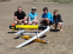
Phytoscope (stands for PHYToplankton biOdiversity multiScale Characterization using advanced Optical technologies) was carried out in the Alfacs bay as a scientific campaign to collect data for the Phytoscope project. This campaign was organized by the ICM (CSIC) and directed by Dr. Jaume Piera. CATUAV participated capturing thermal images with the NEC F30 camera and hyperspectral images with the new RIKOLA. In total, CATUAV made 14 UAV flights that will show the variability of the control ...
MESTRAL – 2012 to 2015
The main goal of the project MESTRAL (stands for Modelling and advanced observational tEchnologies to link tranSport processes, opTically-active constituents, and wateR light-field vAriability in a coastaL ecosystem) was to investigate the presence of small-scale transport processes in the Alfacs Bay, and how they affect the spatial patterns of optically active constituents (sediments, phytoplankton and dissolved organic matter) and the underwater light-field variability. Over three years the Marine Technology Unit (CMIMA / CSIC), directed by Jaume Piera, ...
FLUXPYR – 2009 to 2012
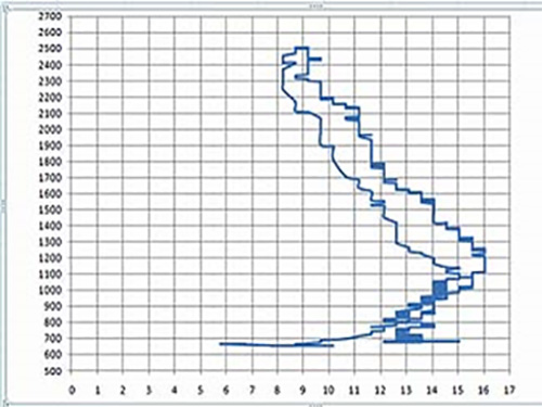
CATUAV and the Catalan Institute for Climate Science (IC3) closed an agreement to conduct a flight campaign to measure the levels of CO2 in the atmosphere. These flights were part of the FLUXPYR project and are intended to complement and contrast the observations of the IC3 network of atmospheric stations. CATUAV performed a special integration for the CO2 probe in the Atmos-5 UAV platform, specific calibration flights and sounding campaigns ...