Since year 2000, we have been working in multiple remote sensing applications such as: precision agriculture, emergencies, humanitarian applications, civil constructions, marine projects, atmospheric studies, environmental projects, archaeology, power lines, energetic efficiency…
These are the outputs that we can generate:
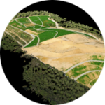
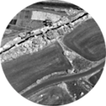
ORTOPHOTO
Consist in assigning an exact coordinate to each pixel. Orthophotos have the same lack of distortion as any map. They can be used to measure distances, surfaces and volumes.
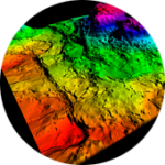
DTM & DSM
Both Digital Surface Model and Terrain Model can be generated from the imagery of any of the used sensors, allowing to get an accurate 3D reconstruction of the landscape.
POINTCLOUD & 3D MESH
Previous to the DTM & DSM generation, a dense point cloud of millions of points is generated. This can be filtered and classified to meet any application requirements.
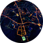
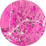
REMOTE SENSING
The data acquired from the different sensors and bands can be combined using special indices and analyzed with remote sensing techniques in order to get out the most of the information contained in the UAV imagery.
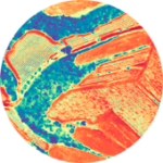
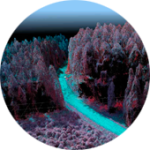
MULTISPECTRAL
We can obtain information of the landscape in 5 or more different spectral bands, allowing the remote sensing specialists to detect differences not visible with only RGB cameras.
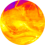
THERMAL
Thermal cameras detect radiation in the spectrum range of 8 to 14 µm. With proper calibration, this allows us to know the temperatura of the sensed objects.
HYPERSPECTRAL
Hyperspectral imagery allows us to sense much more bands than multispectral imagery. The bands are also narrower, so its special useful for research and scientific projects.
NON OPTICAL
We can carry any required sensor for the project with a custom Integration in our UAVs, allowing us to also perform non-optical applications such as atmospheric studies.