Currently, basic Ground Control Stations (GCS) and the most used setup to operate an Unmanned Aircraft Systems (UAS) are composed by a computer that uses a Drone Control Software and a communication antenna.
A recurring problem with these radio control stations is that they need to be located in a specific place close to the drone system in order to have a direct radio link. The controller location is usually outdoors, exposing the operator and the GCS to the meteorology, resulting in screen reflections, rain, wind or even losing the radio link with the Drone, which would mean losing communications and putting the operation safety in danger. On top of the risks associated, the operator needs time and resources to move to that place, which increase costs and time of operations that are crucial for some specific tasks such as emergency responses.
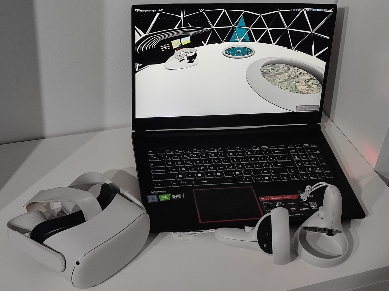
To solve all these problems we have developed the best solution: AEROVR
VR Setup
This solution consists of a virtual control station, where through Virtual Reality (VR) glasses the operator is immersed in a fully functional station connected to a real Drone. The connection uses a 4G link, which solves connectivity problems and allows it to operate the Drone from any part of the world.
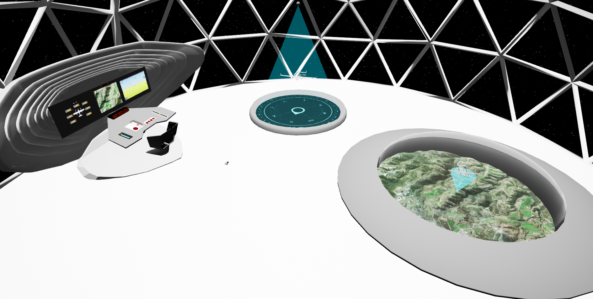
Immersive experience
The main benefit of the virtual GCS solution is that the operator will be able to control the UAS with his hands and clearly view the telemetry and data, while also being able to see a 3D Drone representation that is moving on a 3D map. This will make it easier for the operator to observe the route that the drone is following.
The solution is able to connect to a real UAS and execute real operations, so the operator can to perform a real flight from a virtual environment.
AEROVR deploys data extracted from Copernicus for emergencies and use Galileo technology to navigate precisely to the point where the emergency is. The 3D environment will show the exact location, telemetry, and data of the real Drone.
The final user of the product is the drone operator, who seeks total comfort to execute and control their operations, prioritizing the observation of the data in a much clearer way, which will be allowed thanks to observing Copernicus data. The 3D map and VR environment will ease the operations from anywhere in the world, with the only need of VR glasses and internet connection.